")
Task 101
The Impact of using Lidar Network Data for a Summertime Cold Front Case Study:
Principal Investigator(s):
S. Rabenhorst
Sponsor(s):
D. Whiteman
Last Updated:
October 26, 2012 15:25:21
Description of Problem
Observation acquired during the Water Vapor Variability – Satellite/Sondes (WAVES) 2006 field campaign, centered at Beltsville, MD, provided a unique contiguous five-day period of concentrated high temporal and vertical resolution observations to examine fine-scale detail of a weather regime typical of the summertime Midatlantic area. The observations captured several interesting meteorological phenomenon that could not be explained from observations alone. Therefore, a modeling study was conducted to investigate these peculiarities. The Weather Research and Forecasting (WRF) model was used for detailed simulation of the 1-5 August 2006 events.
Scientific Objectives and Approach
Prior to an in-depth analysis of the August 1-5 2006 case study, studies were conducted in four areas assumed to be most sensitive to the model: (1) initial condition data set, (2) cumulus parameterization, (3) planetary boundary layer parameterization (PBL), and (4) initialization time. WRF verification was performed using the Model Evaluation Tools package using the WRF post processing software. Several observation sources were used in the verification process. Field measurements from Beltsville were used, including local radiosondes, lidar measurements, 31-m flux tower measurements, and surface measurements. More broadly, the National Oceanic and Atmospheric Administration Meteorological Assimilation Data Ingest System (MADIS) data was used. Lastly, National Center for Environmental Prediction Stage IV data was used for precipitation comparisons. Several sensitivity runs were conducted and findings analyzed to determine appropriate model optimization for the case study. Following this, several high resolution model runs were conducted to explore the spatio-temporal evolution of the atmosphere during this case study.
Accomplishments
The model sensitivity studies were done using 54-hour forecasts with an 8 km grid over the eastern US. For the initial condition sensitivity tests, verifications were performed using runs initialized with North American Regional Reanalysis (NARR), North American Mesoscale, and Rapid Update Cycle analysis data. Cumulus sensitivity was done using four runs parameterized with: Kain-Fritsch, Betts-Miller-Janjic, Grell-Devenyi, and Grell-3D schemes. A fifth control run did not use any cumulus scheme. The PBL testing was done comparing the following parameterizations: Asymmetric Convective Model, Bougeault-Lacarrère, Medium Range Forecast, Mellor-Yamada-Janjic (MYJ), Mellor-Yamada Nakanishi and Niño Level 2.5 and 3, Quasi-Normal Scale Elimination, and Yonsei University. Lastly, initialization time sensitivity tests used five runs starting every three hours throughout the convective afternoon period. The sensitivity study indicated the optimized results for this East Coast case study were found using the NARR data for initial and boundary conditions, no cumulus scheme, MYJ PBL parameterization, and a 12Z initialization time.
Precipitation forecasts were challenging under this weather pattern. Most cumulus parameterizations were found to overestimate precipitation across widespread areas. Optimal spin up time was found to be 5-6 hours. Less time led to premature precipitation. More time led to
Page 2 of 138
significant forecast divergence from observations. Prognostic turbulent kinetic energy (TKE) schemes performed best even in convective regions. Even PBL profiles using TKE local closure schemes were over smoothed and over mixed. Overall, it is believed these parameters best represent Midatlantic, and more generally, east coast observations during summertime stable subsidence weather regimes.
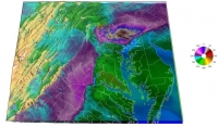
High resolution modeling corroborated field observations. Two significant events were simulated: a nocturnal low-level jet (NLLJ) and a cold front passage. A prominent diurnal cycle was revealed that could be categorized into three stages: (1) daytime PBL growth through convection, characterized by increasingly calm southwesterly wind, (2) flow intensification after dusk, with conditions favorable for NLLJ development, and (3) interruption by downslope gravity winds (DGW) after midnight. The third stage is perhaps most interesting owing to the lack of literature documenting similar DGW occurrences in the Midatlantic. The DGW event was confirmed to be the overt but previously inexplicable signature in Beltsville field observations. More interestingly, the DGW event has a diminishing effect on the Midatlantic NLLJ that suppresses reaching mature development. Perhaps air quality forecasts are most affected by this nocturnal phenomenon.


