")
Task 238
Quantifying Systematic Errors and Total Uncertainties in Satellite-based Precipitation Measurements
Principal Investigator(s):
Y. Tian
Sponsor(s):
C. Peters-Lidard
Last Updated:
October 26, 2012 15:26:05
Description of Problem
Recent evaluations of TRMM-era multi-sensor precipitation products have helped raise the priority of developing improved over-land retrieval algorithms in preparation for the GPM era. An example of recent work evaluating TRMM-era multi-sensor precipitation products (Tian and Peters-Lidard, 2007) has documented systematic biases in overland retrievals related to land surface states—in this case the presence of inland water bodies. Physical precipitation retrievals rely on accurate characterization of the microwave radiometric properties of the land surface. Therefore it is critical to understand how the land surface states can affect these properties, and how we can accurately model these properties, specifically, surface microwave emissivity at various frequencies.
Scientific Objectives and Approach
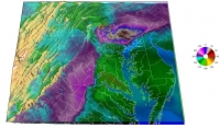
Land surface emissivity is simulated with NASA’s Land Information System (LIS) coupled to various radiative transfer models, including the Community Radiative Transfer Model (CRTM, ver.1 and ver. 2, Weng, et al. 2001) developed at the U.S. Joint Center for Satellite Data Assimilation, and the Community Microwave Emission Model (CMEM, ver. 3, Holmes et al. 2008) by ECMWF. LIS is run with various land surface models to generate a wide range of land surface variables, including soil moisture content, soil temperature, land surface temperature, and snow depth, that are used to drive CRTM or CMEM to produce land surface emissivity values at various frequencies.
Accomplishments
We performed extensive studies with NASA Land Information System (LIS) coupled with radiative transfer models (RTM) such as CRTM. Our results show that the interplay of soil moisture content (SMC) and leaf area index (LAI) is the most critical driver for the dynamics of land surface emissivity. We constructed an SMC-LAI regime diagram to depict the nonlinear dependencies of emissivity on these two land surface variables. Our model tests indicate SMC-LAI can capture most of the variability and serve as an accurate predictor of emissivity.
Specifically, our studies reached the following conclusions:
1) The integrated LIS/RTM framework can generate both realistic land surface hydrologic status and radiometric signatures.
2) Our modeling studies identified that SMC-LAI combined can serve as a good predictor for land surface emissivity.
3) The SMC-LAI regime diagram gives us a unified paradigm to understand the nonlinear interplay of soil and vegetation.
4) More reference data are needed to verify, validate and calibrate model results.
Refereed Journal Publications
Peters-Lidard, C. D., S. V. Kumar, D. M. Mocko and Y. Tian, 2011: Estimating evapotranspiration with land data assimilation systems. Hydrological Processes, 25: 3979–3992. doi: 10.1002/hyp.8387
Other Publications and Conferences
Tian, Y. and C. D. Peters-Lidard, 2011: Uncertainties in TRMM-era precipitation measurements. 2011 AGU Fall Meeting, 5-9 December, 2011, San Francisco, CA, USA.


