")
The Bulletin of the American Meteorological Society (BAMS) featured the work of ESSIC/CISESS scientist John Xun Yang in their March 2024 issue.
In the highlight, the BAMS editor delved into the origins, challenges, and stories behind the development of SatERR 1.0, a comprehensive satellite error inventory and simulator led by John Yang. SatERR is NOAA’s first satellite error inventory and is now accessible as an open-source project on GitHub.
This highlight underscores the significance of the work supported by NOAA projects and enhances the visibility of research at NOAA.
See images below for the two-page spread.
Transcription:
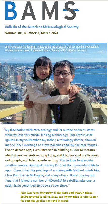
John Yang with his daughter, Alice, at the top of Seattle’s Space Needle, overlooking the bay with the peak of glaciated Mount Rainier in the distance.
“My fascination with meteorology and its related sciences stems from my love for remote sensing technology. This enthusiasm ignited in my youth when my father, a radiology doctor, showed me the inner workings of X-ray machines and my skeletal images. Over a decade ago, I was involved in building a lidar to measure atmospheric aerosols in Hong Kong, and I felt an analogy between radiography and lidar remote sensing. This led me to dive into satellite remote sensing during my Ph.D. at the University of Michigan. There, I had the privilege of working with brilliant minds like Chris Ruf, Darran McKague, and many others. It was during this time that I joined a number of NOAA/NASA satellite missions, a path I have continued to traverse ever since.”
– John Xun Yang, University of Maryland and NOAA/National Environmental Satellite, Data, and Information Service/Center for Satellite Applications and Research
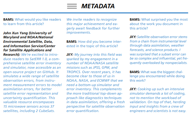
BAMS: What would you like readers to learn from this article?
John Xun Yang (University of Maryland and NOAA/National Environmental Satellite, Data, and Information Service/Center for Satellite Applications and Research): We’re excited to introduce readers to SatERR 1.0, a comprehensive satellite error inventory and simulator, now accessible as an open-source project on Github. It simulates a wide range of satellite observation errors, from instrument measurement errors to model assimilation errors, for better satellite error representation and uncertainty quantification. This valuable resource encompasses 15 microwave sensors across 37 satellites, including 2 CubeSats. We invite readers to recognize this major achievement and eagerly await feedback for further improvements.
BAMS: How did you become interested in the topic of this article?
JXY: My journey into this field was sparked by my engagement in a number of NOAA/NASA satellite missions such as JPSS, GPM, and TROPICS. Over recent years, it has become clear to those of us in NOAA, NASA, ECMWF that we need a bottom-up simulator and error inventory. This complements the more traditional top-down approach like diagnostics techniques in data assimilation, offering a fresh perspective for satellite observation error quantification.
BAMS: What surprised you the most about the work you document in the article?
JXY: Satellite observation error stems from a chain from instrument level through data assimilation, weather forecasts, and science products. I was surprised that a subset error can be so complex and influential, yet frequently overlooked by nonspecialists.
BAMS: What was the biggest challenge you encountered while doing this work?
JXY: Cooking up such an intensive simulator demands a lot of coding, not to mention the workload of validation. On top of that, herding input and insights from a crew of engineers and scientists is not easy.


