Chesapeake Bay has ‘favorable’ summer, finds ESSIC-supported NOAA report
Cazzy Medley
Highlights
The Virginian-Pilot featured a news article on November 5 highlighting a NOAA report containing an operational satellite data product from ESSIC/CISESS Senior Faculty Specialist Ron Vogel. The report, Synthesis of Environmental Impacts on Key Fishery Resources in the Chesapeake Bay, is released seasonally by the NOAA Chesapeake Bay Office and is used by regional fishery managers to help guide management decisions.
The report uses data from satellites, buoys, flow gauges and forecast models to describe seasonal water temperature, salinity, streamflow, hypoxia and other environmental factors for managers to understand how current environmental conditions may affect the future of economically important fish species and other marine resources.
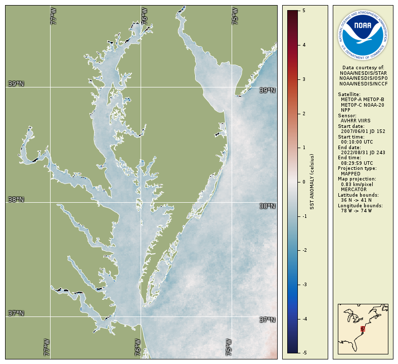
Ron Vogel produces seasonal water temperature anomaly maps for the reports and participates on the report’s research team. As part of CISESS, Ron’s work supports the NOAA CoastWatch Program, whose regional nodes work directly with stakeholders to apply NOAA’s satellite data to decisions that help society address a changing environment.
Summer 2023 water temperature anomaly map for Chesapeake Bay shows a 1 degree C decrease in temperature compared to a 2007-2022 baseline, indicating favorable conditions for several key fish species, according to the seasonal fishery impacts report released by the NOAA Chesapeake Bay Office and containing data generated by UMD/ESSIC/CISESS.

")


