")
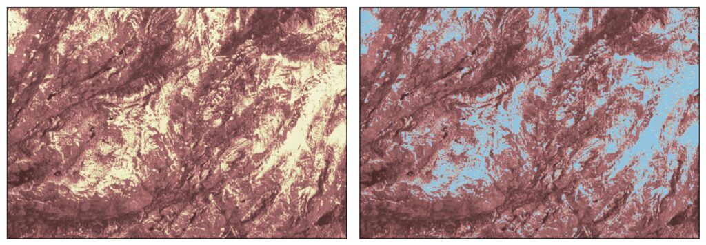
1.2 billion people around the world rely on seasonal snow for their water supply. However, no snow-focused satellite currently exists. The satellites that do attempt to look at the spatial coverage and temperature of snow often struggle to retrieve information about snow in forested regions, which accounts for nearly half of Earth’s snow cover. The forest canopy blocks a lot of satellite remote sensing retrievals, forcing scientists to rely on models. However, processes that control how snow accumulates and melts are pretty different in forested and exposed locations. For example, warmer forests like in the US Pacific Northwest have larger amounts of snow intercepted by the forest canopy and winter snowmelt. This typically makes snow last longer in clearings than in the forest. The opposite is true in colder climates, where snow tends to last longer in the forest.
A new project supported by NASA’s Research Opportunities in Space and Earth Science (ROSES) and the Commercial Smallsat Data Acquisition (CSDA) program seeks to fill this research gap using imagery from PlanetScope, a constellation of commercial nanosatellites called the “Dove” satellites.
“Some of our best practices use snow cover observations to help us model and estimate snow water resources, but this could bias our estimates of snow volume since we’re only able to observe snow cover predominantly outside of forests,” says Justin Pflug, a scientist at ESSIC and Principal Investigator of the project, “We want to see whether we can use observations from commercial satellites to identify snow cover and snow disappearance timing in much smaller forest gaps, and see whether that information changes our estimates of snow water resources important for things like agriculture, hydropower, wildlife and ecological health, and human consumption.”
The team will use the snow cover maps generated by machine learning methods and observations from the Dove satellites to observe fine-scale spatial patterns of snow disappearance timing. They will then attempt to back-calculate the spatial and temporal evolution of snow water resources.
The researchers hope to see whether frequent and fine-resolution commercial satellite imagery can provide the opportunity to peer into forest regions and observe how snow patterns change over space and time. They will then compare the results with other satellite data to understand the needs for a snow-focused satellite mission in different climates.
“We hope that this project will be able to point out when and where we may be leaving out important information about forest snow.,” says Pflug, “As much as half of the world’s snow cover is in forests, so there could be widespread benefits to identifying and correcting where and when coarser-resolution observations mischaracterize snow cover in forests, both from existing constellations of satellites, and if a snow-focused satellite were to exist in the future. This might also help us develop better model representations of the complex snow processes in forests that we currently struggle with, like snow interception, canopy shading, canopy longwave emission, and wind-sheltering.”
The project officially begins in the coming months and is funded for 2 years on the NASA ROSES Commercial Smallsat Data Scientific Analysis proposal. This project will be performed with researchers from the University of Washington (Dr. Nicoleta Cristea) and NASA Goddard (Dr. Sujay Kumar and Dr. Carrie Vuyovich).


