![Figure: The dotted line indicates model domain boundaries used for this study, which are plotted alongside (solid black lines) land boundaries. For reference, (red lines) contours of modeled surface pressure are plotted every 5 hPa along with locations of measurements at a single time (00 UTC8 September 2017). The red hatched region indicates the domain over which verifications were performed.](https://essic.umd.edu/wp-content/uploads/2022/04/poterjoy_figure1.png)
Multivariate Non-Gaussian Data Assimilation for Multi-scale Weather Prediction
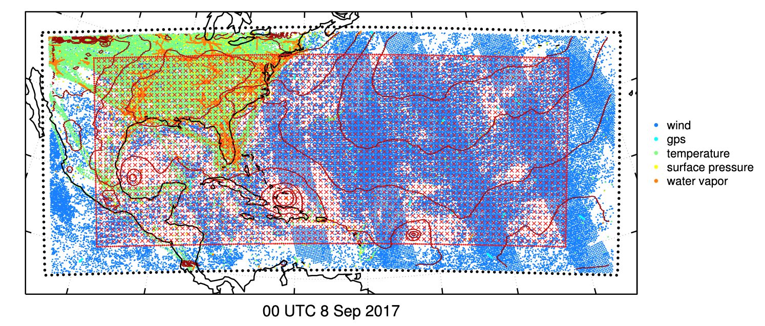
ESSIC/CISESS Scientist and Department of Atmospheric and Oceanic Science Professor Dr. Jonathan Poterjoy has recently examined the fidelity of error assumptions made by regional weather prediction systems using a novel technique that avoids common approximations.