Monitoring California Flooding Using VIIRS and Sentinel-1
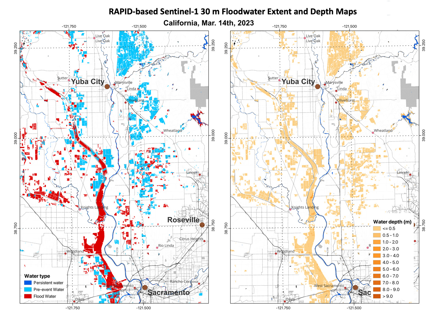
ESSIC Associate Research Scientist Qingyuan Zhang recently used VIIRS daily 375m flood extent products on 3/8/2023, 3/11/2023, 3/13/2023 and 3/15/2023 to monitor flooding in California.

ESSIC Associate Research Scientist Qingyuan Zhang recently used VIIRS daily 375m flood extent products on 3/8/2023, 3/11/2023, 3/13/2023 and 3/15/2023 to monitor flooding in California.

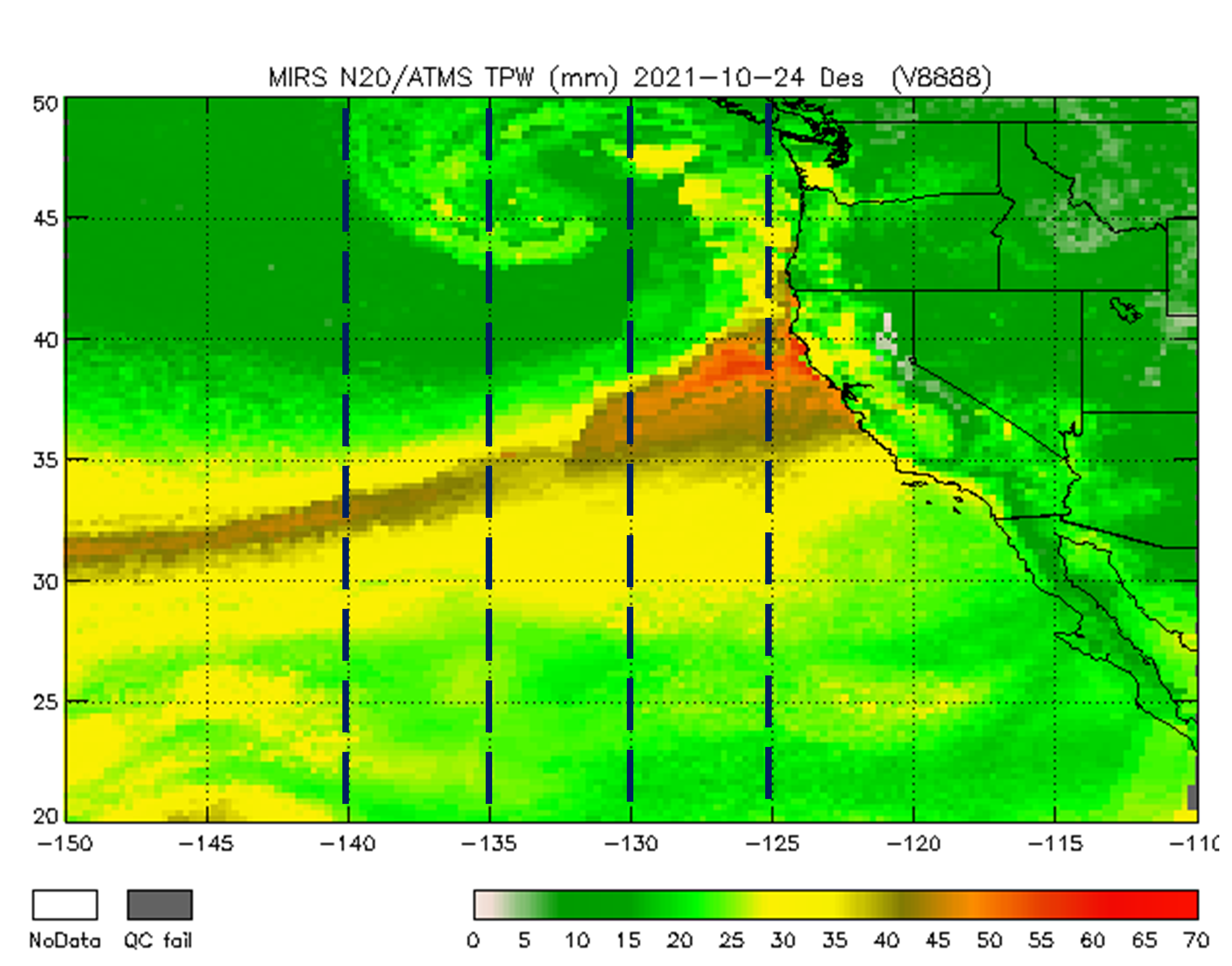
On October 24, a powerful Category 5 (the maximum possible) atmospheric river (AR) occurred over the northern and central parts of California. The storm system featured record breaking precipitation, leading to flooding and mudslides in some locations, along with dangerous winds exceeding 70 miles per hour at higher elevations. San Francisco recorded its fourth highest single-day rainfall amount of over 4 inches. Satellite passive microwave measurements are one of the observational tools that allow depiction of these extreme events, since microwaves are less affected by clouds and precipitation.