")
Accelerating the Exploitation of Satellite Observations to Improve Flood and Inundation Monitoring and Forecasts
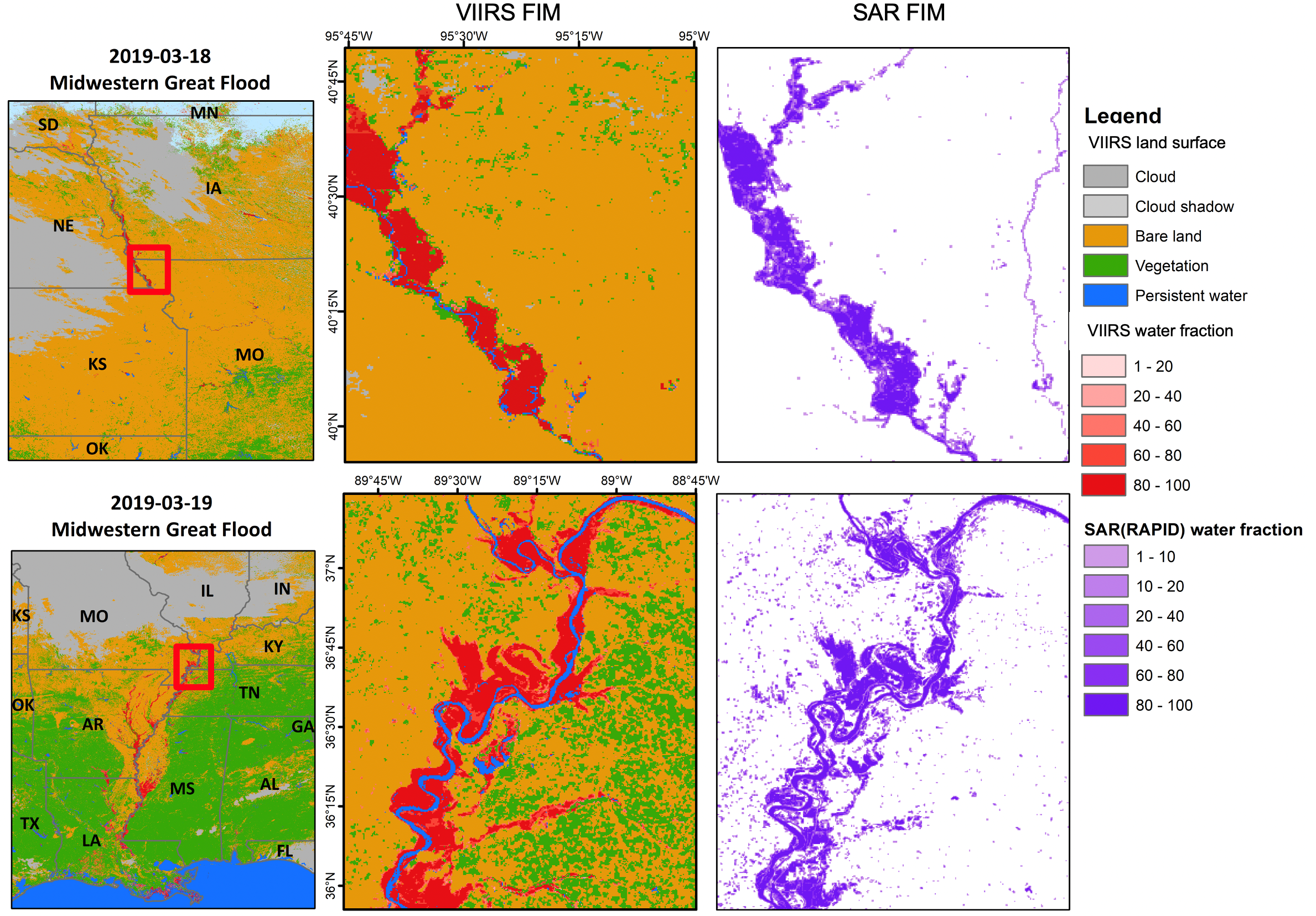
ESSIC/CISESS Scientist Qingyuan Zhang and their colleagues have developed a framework to compare Visible/Infrared Imager Radiometer Suite (VIIRS) Flood Inundation Maps (FIM) with Sentinel-1 synthetic aperture radar (SAR) FIM.
